Top 15 Famous Natural Landmarks Around the World
 Planet
earth is home to some of the most wondrous and beautiful places. While many of
the landmarks discussed here are formed naturally, other landmarks are formed under unique
circumstances. Some of these landmarks tend to baffle scientists, who find it
hard to find a substantial explanation. The beauty that encompasses most of
these gorgeous landmarks
attracts thousands of visitors throughout the year. Most of these landmarks are
protected by the governments of the country in which they are located, and are
respected by those who visit. Planet
earth is home to some of the most wondrous and beautiful places. While many of
the landmarks discussed here are formed naturally, other landmarks are formed under unique
circumstances. Some of these landmarks tend to baffle scientists, who find it
hard to find a substantial explanation. The beauty that encompasses most of
these gorgeous landmarks
attracts thousands of visitors throughout the year. Most of these landmarks are
protected by the governments of the country in which they are located, and are
respected by those who visit.
15) Trona Pinnacles
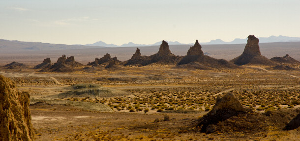
Located in the dried out basin of the Searles Lake, about
10 miles south of Trona, Calif., are the Trona Pinnacles. The pinnacles are
located at an elevation of about 1,800 feet above sea level. The pinnacles are
considered to be one of the most unusual geological landmarks in the California
Desert. The tufa spires are porous rocks that were formed from the lakes
interaction with other bodies of water. This interaction occurred when a massive
runoff spilled into the lake from the Sierra Nevada during the Pleistocene
period. There are over 500 tufa spires, all varying in shape and size. Almost
100,000 years ago, the youngest group of pinnacles began to form under water.
The pinnacles are comprised mostly of calcium carbonate.
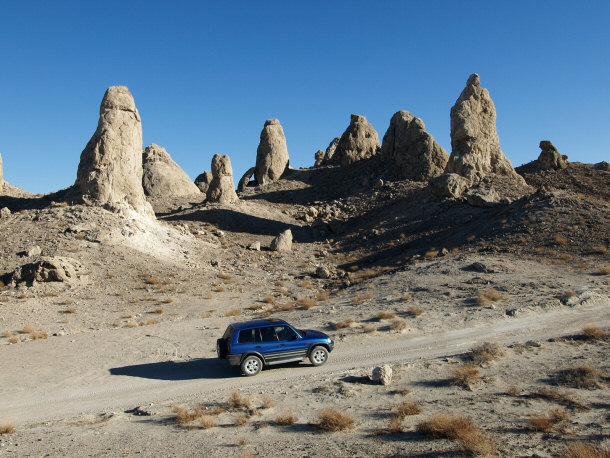
Though the Searles Lake has long since dried up, the Trona Pinnacles stand
tall, slowly eroding as the years go by. The Trona Pinnacles have become a
popular back drop for many different movies. Over 30 different movies have
featured the Trona Pinnacles, including "Planet of the Apes ," "Battle Star Galactica ," "Battle Star Galactica ," and "Lost in Space ," and "Lost in Space ." ."
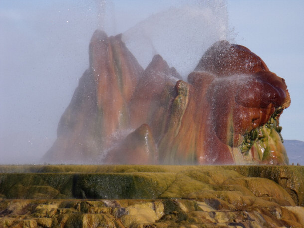
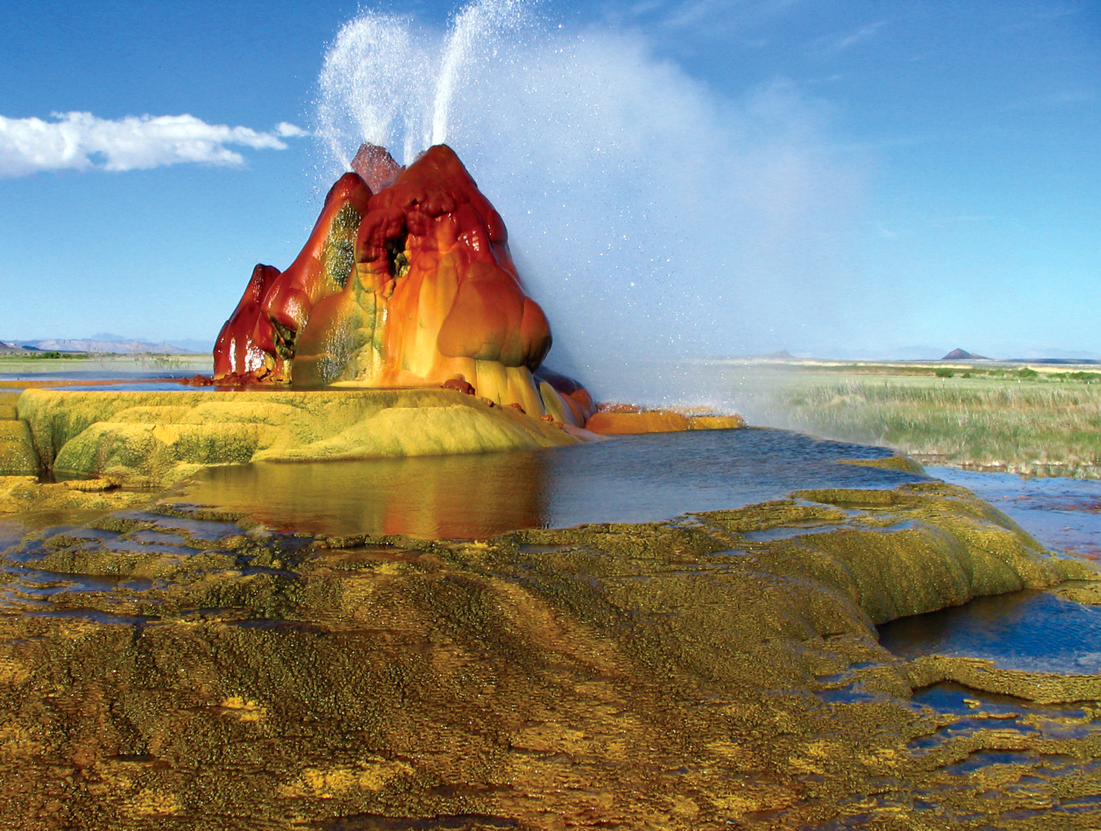
14) The Fly Geyser
Located in the million-acre Black Rock Desert on Fly
Ranch Geyser in Nevada, is the Fly Geyser formation. Though the geysers have the
appearance of an odd, alien structure, they are actually man-made. The first
geyser was accidentally created almost 100 years ago when a well was drilled in
an effort to make the area suitable for farming. A well was drilled and boiling
water was found. This boiling water was not suitable for irrigation purposes,
and so the geyser was left alone. Over the years, a cone that is almost 12 feet
tall was formed.
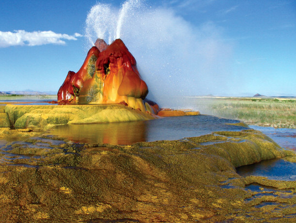
The second geyser was created in 1964. A geothermic energy company used the
same area to drill a test well. Though the water was 200 degrees, it was not hot
enough for the company’s purpose. The company sealed the test well, but the seal
did not hold. This geyser stole the water pressure from the original geyser,
which caused it to become a dormant cone. Over the last 40 years the geyser has
continued to grow as the geothermal water pocket deposits minerals on the
surface of the desert. The cone is covered in green hues caused by thermophilic
algae. The water is consistently spewed and can reach up to 5 feet in the air.
The geyser has several terraces that discharges water into almost 40 different
pools. Both of the geysers, though located on private land, are visited by many
people every single year.
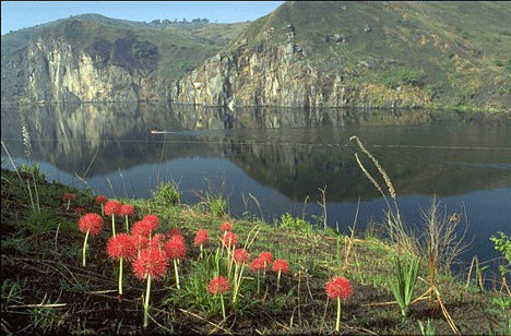
13) The Three Deadly Lakes
Another bizarre occurrence in nature is the three
deadly lakes in Africa. Lake Nyos, Lake Kivu, and Lake Monoun make up the deadly
trio of natural water landmarks, and two have been responsible for the deaths of many. The reason that
these lakes are considered to be so deadly is because they explode and create
poisonous gases. Though there are many theories to the actual cause of these
explosions, they are still being debated and, so far, cannot be prevented.
Lake Monoun:
In addition to the explosions that take place in Lake Monoun, the lakes
creation is quite unique. In Cameroon, Africa the earth’s crust is weak, which
causes magma to easily rise to the earth’s mantle. When rising, the magma shoots
up quickly, and cuts a tube toward the surface. When the magma hits wet rock, it
will explode. Craters are formed, and water fills to crater to create a lake.
This is how Lake Monoun was formed over 18 thousand years ago. Because the lake
is located on top of the earth’s weak crust, the explosions continue to occur.
In 1984, a limnic eruption occurred and a large amount of carbon dioxide was
released into the air. This explosion caused the death of 37 residents.
Lake Nyos:
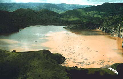
Lake Nyos was formed naturally in the same fashion as Lake Monoun, but is only 400
years old. In addition to explosion, the water of the lake has been turned into
carbonic acid. When the lake exploded in 1986 a massive cloud of CO2 was
emitted. The explosion also caused a wave that was estimated to be around 80
feet tall. The cloud suffocated almost 1,700 people and over 3,5000 livestock.
Though so many lives were lost, most of the vegetation in the area was unharmed.
The previously bright blue water turned a red, copper color. Over 4,000
inhabitants fled the area. In 2008 Lake Nyos was named the most deadly lake in
the world.
Lake Kivu:
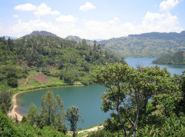
Though Lake Kivu has not caused any deaths yet, the risk of a massive death
toll is much higher. The lake is located next to the volcanic Mount Nyiragongo.
The lake is about 2,000 times larger than Lake Nyos, and holds a much larger
population. Though the lake has not reached a high level of CO2 saturation, many
say it is just a matter of time.
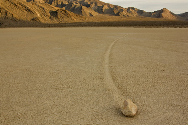
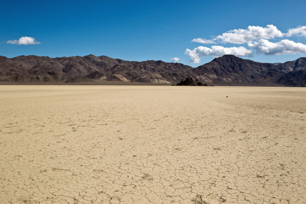
12) Racetrack Playa
One of the most unique mysteries in the Death Valley
Region in California is the sliding rocks of Racetrack Playa. This natural
landmark stretches for
about 2.8 miles, and is located 3,608 feet above sea level. For most of the
year, the playa’s climate is dry, and does not have any vegetation. The rocks
are found on the floor of the dry lake bed and usually have long trails behind
them. These rocks typically weigh in at around 700 pounds, which makes their
movement such a mystery. The shape of the trails behind the rocks suggests that
the rocks move when the floor of the playa is covered in mud. It does not,
however, explain how the rocks were moved. Thus far, the movements of the
Racetrack stones have not been captured on film.
There are many different theories on just how these heavy rocks are moved.
Some believe that strong gusts of wind are responsible for pushing the rocks.
The slight curves in the trails suggest that this theory is possible, but it has
not been proven. Another theory is that the presence of ice on the playa is
responsible for the movement. Though many support this theory, there is still
the fact that ice would probably leave marks on the surface of the playa.
The
mystery of how these rocks move brings many curious travelers to this strange
natural landmark to see
if they can figure it out for themselves.
11) The Door to Hell
Another manmade
landmark is the Door to Hell. Located in Derweze, Turkmenistan in the Karakum Desert (central Asia), the Door to Hell is a giant hole of
fire. The Door to Hell name was given to the field by locals who have become
accustomed to the fires, orange flames, and boiling mud. The Door to Hell was
created when Soviet geologists drilled the site in 1971. The geologists tapped
into a cavern that was filled with natural gas. When the ground beneath the
drilling rig collapsed, a hole with a diameter of 70 meters was created.
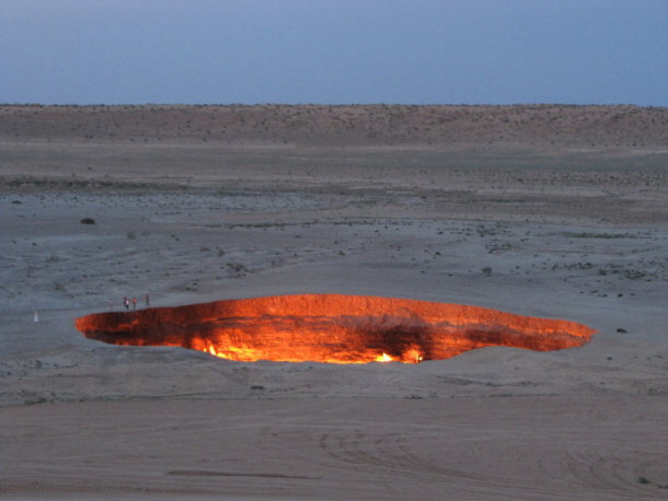
The team of geologists was afraid that poisonous gases would be released
through the hole so they burned it off. The geologist’s hoped that the fire
would use all of the fuel that leaked, but it is still burning today, over 40
years later. The flames from the fire generate an eerie glow, which can be seen
from miles away. People from all over the globe come to visit this man-made
landmark every year so that they can peer into the Door to Hell.
And yes, you can get up close to this spectacular landmark:
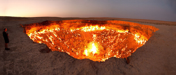
By Tormod Sandtorv
via Wikimedia Commons
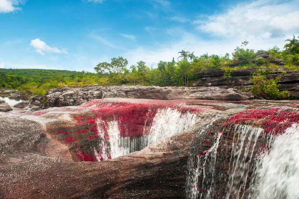
10) Cano Cristales
Every year, for a few weeks from September to November, the
normally plain Cano Cristales attracts hundreds of tourists. This natural
landmark is located in Columbia
in the Sierra de la Macarena, the rive Cano Cristales is normally
indistinguishable from any other river. The location of Cano Cristales is
remote, and not easily reached by the roads. For easier and more frequent
access, tourists can choose to fly to the town of La Macarena, which is nearby.
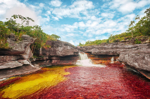
By Mario Carvajal (Own work) [CC-BY-3.0],
via Wikimedia Commons
From La Macarena, tourists will need to take a trip into Serrania de la
Macarena. From September to November the water level of the river drops enough
for the sun to warm the moss and algae that lies at the bottom of the river. The
warmth from the sun causes the river to erupt in the blooming of the rare
Macarenia Clavigera. This rare plant has bright red blooms that make the river
erupt with color.

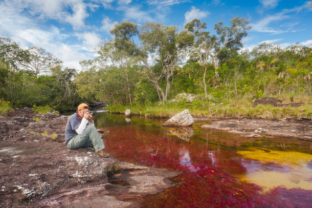
The bright red color of the Macarenia Clavigera makes the yellowish green
sand, and the blue water stand out against the rocks. The mixture of the reds,
yellows, greens, and blues give the river an appearance of a watery rainbow. It
is a unique occurrence that cannot be witnessed anywhere else in the world. Many
tourists make the trek to Columbia during September and November in hopes of
being able to see the colorful river. Throughout Columbia’s wet season, the
river's water flows fast and deep. This prevents the Macarenia Clavigera from
getting the sun that is needed for it to turn red. When there is not enough
water in the dry season, there is not enough water to support the life that can
be found in the river.
By Mario Carvajal (Own work) [CC-BY-3.0],
via Wikimedia Commons
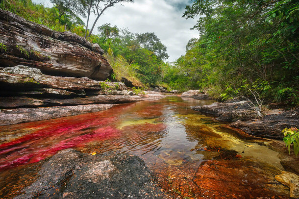
Cano Cristales is Very Colorful!
By Astromario (Own work) [CC-BY-SA-3.0],
via Wikimedia Commons
Cano Cristales is Beautiful!
By Mario Carvajal (Own work) [CC-BY-3.0],
via Wikimedia Commons
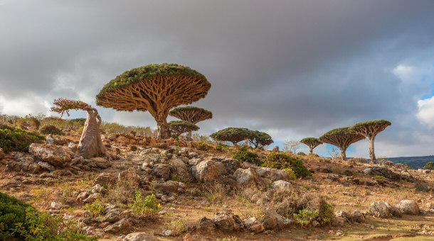
9) Socotra
This natural landmark is located 220 miles from Yemen is the island of Socotra. The island
is home to a variety of unique species, many of which cannot be found anywhere
else on earth. For many different reasons the island is viewed as a natural
wonder. Many of the different species of plant life tend to excite scientists,
as they are extremely rare. The island is one of the most isolated pieces of
land, which is why it has retained its natural beauty.
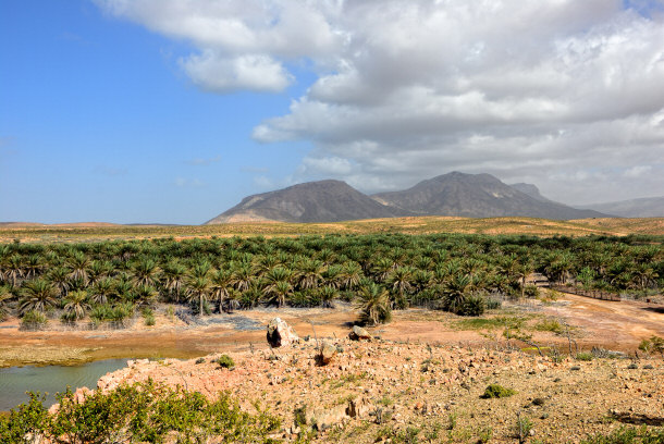
It is suspected that the island detached itself from Africa, similar to the
way that the Gulf of Aden was created. Socotra is an archipelago that is made up
of four different islets and islands. The flora found on the islands are able to
withstand severe heat, but are extremely sensitive to change. One of the most
unique plants that can be found in Socotra is the Dragon’s Blood Tree. The tree
is umbrella shaped, and leaks blood-red sap, which used to be used for medicines
and dye. The only mammals that are native to Socotra are bats and civet cats.
The archipelago’s ability to self-sustain itself, while housing so many rare
flora species, leaves an impression on anyone who chooses to visit.
Dragon’s Blood Trees:
8) The Wave
Located on the Utah and Arizona border is the Coyote Butte area of
the Paria Canyon-Vermillion Cliffs Wilderness. This natural landmark is home to the popular
hiker attraction, The Wave. The Wave is a chute that is multicolored and beautiful
to see. The Wave has intersecting U-shaped troughs that were created during the
Jurassic age. When the troughs were created, the drainage basin that fed the
troughs rain water shrank in a way that made the runoff insufficient in
contributing to the cutting of the troughs. Because of this, the troughs are
exclusively eroded by wind.

Made up on Navajo Sandstone, The Wave is composed of cyclic and rhythmic
grain flow. Differential erosion, cyclic grain flow, and wind-ripple laminae
result in the ribbing and ridges that can be seen within The Wave. Confirming
the age of the site are the many different Dinosaur tracks and fossils that have
been found throughout the Wave. It is a site that has evolved over millions of
years, and is expected to continue to evolve as time goes by.

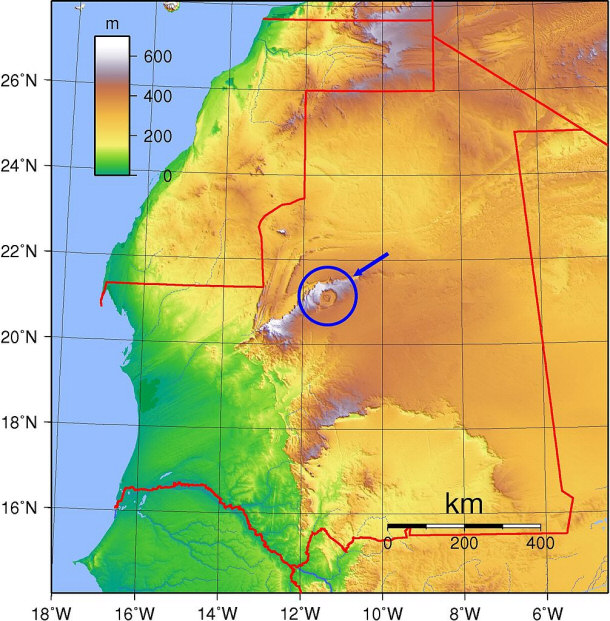
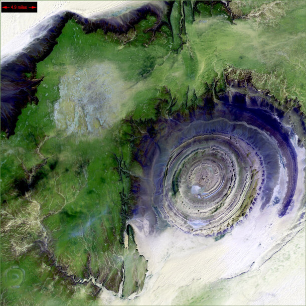
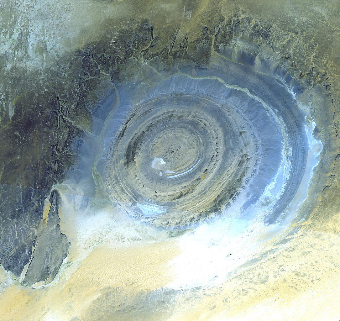
7) Richat Structure
The Richat Structure, also known as the Eye of the Sahara,
is a natural wonder whose creation is still debated. A prominent circular
structure that can only be seen clearly from space, the Richat Structure is
located in the Sahara Desert in west-central Mauritania, Africa. The structure is
surrounded by miles of desert and measures to 40-50 km in diameter. The
structures bulls-eye feature has attracted attention since the very first space
mission.

While some believe that this famous site was created by an ancient meteor, others
believe that the structure was created by a small incursion of magma. The Richat
Structure is made of sedimentary rock that is over two billion years old, and
Ordovician sandstone that is well over 480 million years old. It is believed
that the circles of the structure are actually layers that alternate. In this
theory, the layers consist of sedimentary, metamorphic, and igneous rocks that
were pushed into a geological dome.
One last pic of this beautiful landmark:
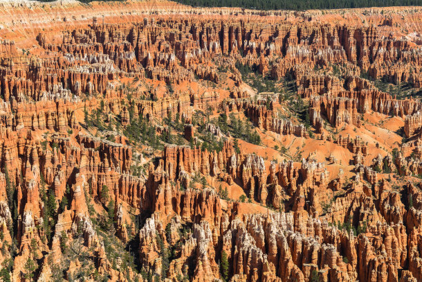
6) Bryce Amphitheatre
Located in Southwestern Utah is the Bryce Canyon
National Park, as shown below:

This famous national park is home to the Bryce Amphitheater. The Bryce
Amphitheater is the most visited area in the Bryce Canyon National Park. This is
mostly due to the unique formations that can be found within the amphitheater.
The Bryce Amphitheater is a break that has eroded into the Paunsaugunt Plateau
slope. Capping the plateau is rock that has a pink hue, and has varying degrees
of hardness. While the softer rock has eroded over the years, the harder rock
remains. This harder rock is continuously eroded by water and wind. This erosion
provides the amphitheater with a variety of interesting shapes.
Bryce Amphitheater:
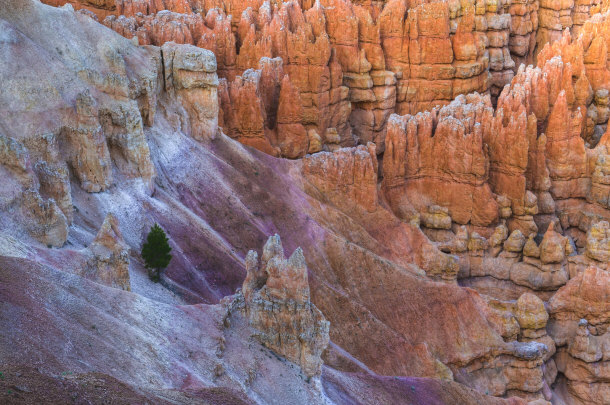
One of the most known shapes in the Bryce Amphitheater is the hoodoo. Created
by years of erosion, hoodoos have a shape that strongly resembles a totem pole.
The hoodoos at Bryce Amphitheater range in shape and in height. The rock layer
that forms the hoodoo structures is better known as the Claron Formation. Over
40 million years ago the formation was emerged in water in a lake that covered
most of present-day Utah. As the years passed and minerals were deposited, the
hoodoos developed different colors throughout their height.
Bryce Amphitheater's Hoodoos:
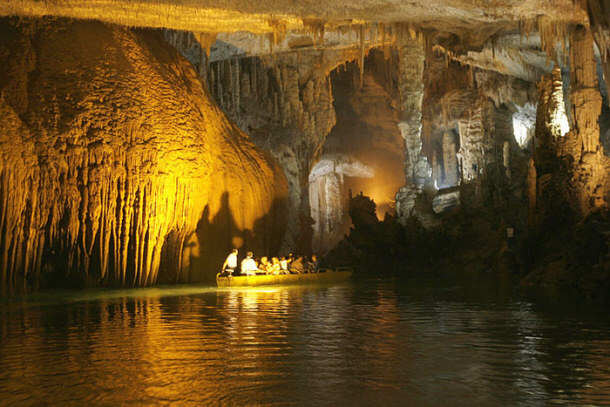
5) Jeita Grotto
Considered to be one of the most beautiful caverns in the
world is the Jeita Grotto. The Jeita Grotto is located in the Nahr al-Kalb
valley near Jeita, Lebanon. The cave attracts thousands of visitors every year,
and is known for the many unique formations that evolved over millions of years.
The cave shows signs of inhabitation during prehistoric times, but was popularly
rediscovered by Reverend William Thomson in 1836.

The cavern is comprised of upper and lower cavers, and can only be accessed
by boat. The lower galleries of the cavern showcases clean water, beautiful
formations, and a rushing waterfall. The upper galleries feature a concrete
tunnel that is 120 meters long, and a maze of dramatic formations. Though the
method of formation is known to be water and time, the sites ability to create
such unique structures is quite amazing. The formations inside of the cavern
have a cathedral feel to them, and have provided a beautiful backdrop for
concerts and cultural events. In addition to the evolving beauty of the
formations, the cave serves a very important function for the Lebanese. The
water that is found in the Jeita Grotto supplies the locals with drinking water.
Tour Jeita Grotto by Boat:
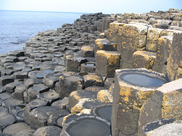
4) Giant’s Causeway
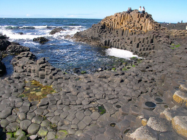
By code poet (Own work) [CC-BY-3.0],
via Wikimedia Commons
Located in County Antrim in Northern Ireland, is the
Giant’s Causeway. The Giant’s Causeway is an area of about 40,000 basalt columns
that interlock. Between 50 and 60 million years ago, present day County Antrim
was subjected to volcanic activity. During this volcanic activity fluid molten
basalt came through the chalk beds and formed a lava plateau. As the lava
cooled, horizontal contraction took place. As the mass cooled, the horizontal
contraction created pillar like structures. The size of the columns was
determined by the rate at which the lava cooled. Even with this scientific
explanation, the shapes of the columns continue to intrigue those who visit the
site.
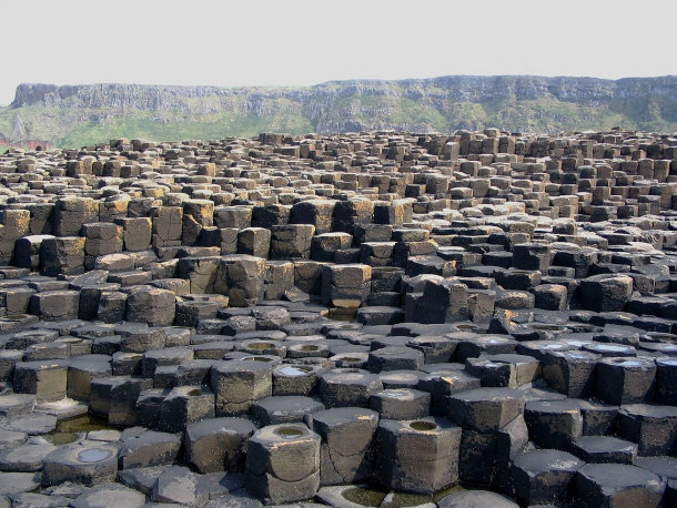
Though the scientific reason for the formation of the Giant’s Causeway has
been well proven, there is a legend that is used by many to explain the
formation. According to this legend, the formation was built by an Irish giant
named Fionn mac Cumhaill. In the legend Fionn was challenged to a fight by
Benandonner, a Scottish giant. When the giant’s met and fought, the formation
was created. This legend gives a mystical explanation to the formation of a
naturally beautiful site that has an other-worldly feel.
3) The Great Blue Hole
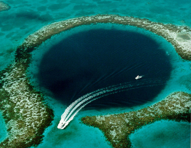
The Great blue Hole is a massive blue hole located off
of the coast of Belize. The hole is perfectly circular, and is the world’s
largest blue hole. The Blue Hole was formed as a result of several collapses of
a limestone cave system. The cave system was formed during the last ice age. At
high tide, the Blue Hole is only a few feet deep. The middle of the Blue Hole
reaches depths of almost 480 feet. Before it was a Blue Hole, the site was a dry
cave filled with stalactites and stalagmites. After the last ice age, the sea
level rose to cover the cave. It is suspected that a major earthquake caused the
ceiling of the cave to collapse. Now the circumference of the Blue Hole is lined
by shelves and ledges that have been carved by the sea. Adding to the natural
wonder are the species of ocean life that can be found at the site. The
beautiful stalactites and stalagmites, in addition to the ocean life, make the
Blue Hole won of the best places for scuba diving.
Coral Life Inside the Blue Hole:
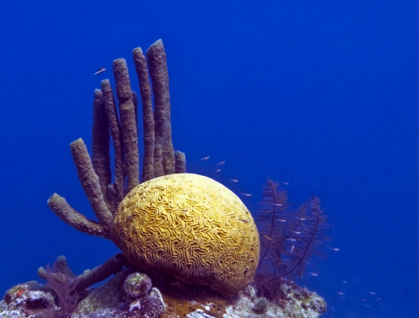
By jayhem (//www.flickr.com/photos/jayhem/3168972954/) [CC-BY-2.0],
via Wikimedia Commons
National Geographic Aerial Photograph:
 belize-blue-hole-reef-731526-sw by EVS-Islands, on Flickr")
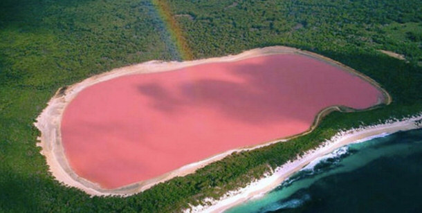
2) Hillier Lake
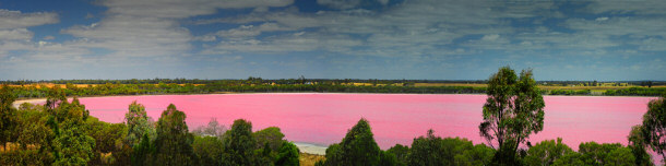
Located in Recherché Archipelago in Western Australia is
Hillier Lake. The lake is one of the most bizarre natural landmarks on earth.
Hillier Lake is surrounded by dense woodland area and a rim of sand. The length
of the lake measures about 600 meters. The reason that the lake is so unique is
the intense pink hue that it possesses. Despite many different tests and
investigations, the reason for the bright pink hue is currently unknown. Even
when water is removed from the lake, it retains its unique coloring.
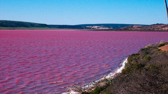
One theory for the unique coloring is that is caused by dye created by
different organisms. Another theory is that red halophilic bacteria in the salt
crusts are the cause for the hue. Neither theory has been proved, and the cause
of the pink water still remains a mystery. Interesting enough, the pink water
has no known adverse affects on humans. The unique coloring of the lake is
enjoyed by many who visit Western Australia, and is considered to be one of the
most intriguing natural landmarks.
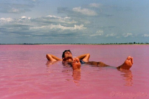
You can swim in it!
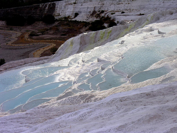
1)
Turkey’s Cotton Castle
Turkey is
a fantastic landmark to visit.
One of the most unique geological landmarks is
Turkey’s Cotton Castle. Named for the portion of the sites concentric
appearance, Cotton Castle has an ethereal appearance. The site has an organic
feel to it because of the calcium carbonate that is deposited by the hot
springs. From a distance, the cliffs surrounding the site look like they could
be made from chalk. The site is home to 17 different hot water springs that vary
in temperature, from boiling to lukewarm. When the calcium carbonate from the
hot springs is first deposited, it is in the form of a soft gel. That gel
eventually hardens and becomes a part of the structure.
By Dennis Jarvis from Halifax, Canada [CC-BY-SA-2.0],
via Wikimedia Commons
Adding to the sites ethereal feel are the presence of ancient buildings. The
Cotton Castle used to be the site of the ancient city Hierapolis. The Greeks
appropriately utilized Hierapolis as a spa town for the extremely wealthy. The
old tombs and uniquely designed buildings have been incorporated into the rock
formation and provide the area with an almost eerie backdrop. Over the years,
these buildings have become buried or incorporated into the site by the high
levels of calcium carbonate. The mineral water cascades over all 17 springs, and
creates terraces and pools that are visually stunning. The spring water is
believed to have curing powers by many. The cures that are said to be popular
include circulation, blood pressure, eye disease, and skin disease. This belief
is just one of the many reasons that people continue to visit from all over the
world.


Conclusion
The many different natural landmarks of earth only prove that the planet needs
to be well cared for. While the Deadly Seas are a threat to humans entering to
that territory, the other sites serve to bring wonder to many. Though most of these
landmarks evolve due to natural causes, they are unique in the fact that their
formation has caused many experts to question the cause of their formant. The
landmarks that have been created due to man-made mistakes have evolved into some of
the most unique landmarks on the planet. These man-made creations prove that
interference from the environment is necessary for human work to have a stunning
appearance.
Locations
Top Lists:
15 Amazing Man-Made Islands
Top 15 Amazing Gothic Architecture Around the World
Top 15 Interesting Facts about Niagara Falls
Top 15 Fascinating Facts about the Great Wall of China
Top 15 Most Beautiful Mountain Ranges Around the World and How to Enjoy Them
Top 15 Famous Castles, Palaces, and Towers
Top 15 Best Zoos in the World
Top 10 Coldest Places in the World
Top 15 Most Beautiful Cities in the World
15 Fascinating Facts about the Eiffel Tower
Top 10 Best Museums in the World
Top 15 Most Famous Theatres in the World
Top 15 Largest Cathedrals in the World
Top 15 Famous Palaces in the World
Top 15 Largest Libraries in the World
15 Unique & Beautiful Tourist Attractions That Evolved By Mistake
Top 15 Best Chocolate Destinations in the World
Top 15 Cities with the Best Gourmet Food
15 Amazing Statues Unknown to the World
Top 10 Natural Wonders of the World
Top 10 Nightlife Cities in the World
|


 ," "
," " ," and "
 ."
."


.jpg/1280px-CAÑO_CRISTALES,_SECTOR_LOS_OCHOS_(COLOMBIA).jpg)


.jpg)


.jpg)
.jpg)